Wielkopolska Biblioteka Cyfrowa udostępnia 457 971 obiektów cyfrowych
Obiekt
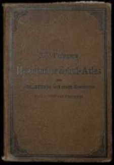
Tytuł: F. W. Putzgers Historischer Schul-Atlas zur alten, mittleren und neuen Geschichte in 66 Haupt- und 63 Nebenkarten.
Współtwórca:
Baldamus, Alfred (1856–1908) ; Putzger, Friedrich Wilhelm (1849–1913)
Wydawca:
Ausgeführt in der Geographischen Anstalt von Velhagen und Klasing
Miejsce wydania:
Opis:
Zwanzigste Auflage ; 18,5x26 cm ; XII s. [tekst], 36 ark. [mapy] , 26x18,3 cm ; Def.: 9 mapa luźna ; Na tabl. 13-15, 17, 19, 28-29 notatki rkps w j. pol. ; Na przedniej wyklejce recenzje atlasów szkolnych wydawnictwa. ; Na tylniej wyklejce reklama wydawnictw Velhagen & Klasing. ; W atlasie znajdowała się luźna mapa obustronna.
Język:
Sponsor digitalizacji:
Format obiektu cyfrowego:
Sygnatura:
Udostępniane przez:
Prawa:
Prawa dostępu:
Digitalizacja:
Lokalizacja oryginału:
Kolekcje, do których przypisany jest obiekt:
- Wielkopolska Biblioteka Cyfrowa > Wielkopolska Biblioteka Cyfrowa - Kolekcja Główna
- Wielkopolska Biblioteka Cyfrowa > Wielkopolska Biblioteka Cyfrowa - Kolekcja Główna > Dziedzictwo kulturowe
- Wielkopolska Biblioteka Cyfrowa > Instytucje współtworzące > Biblioteka Kórnicka PAN
Data ostatniej modyfikacji:
8 paź 2019
Data dodania obiektu:
8 paź 2019
Liczba wyświetleń treści obiektu:
910
Liczba wyświetleń treści obiektu w formacie DjVu
165
Wszystkie dostępne wersje tego obiektu:
https://www.mirabilia.amu.edu.pl/publication/557882
Wyświetl opis w formacie RDF:
Wyświetl opis w formacie OAI-PMH:
| Nazwa wydania | Data |
|---|---|
| F. W. Putzgers Historischer Schul-Atlas zur alten, mittleren und neuen Geschichte in 66 Haupt- und 63 Nebenkarten. | 8 paź 2019 |
Obiekty Podobne
Gueudeville Châtelain, Henri Abraham
Las Cases, Emmanuel (1766-1842 ; comte de) Lasteyrie, Charles Philibert (1759-1849 ; agronom ; litograf)
Gueudeville Châtelain, Henri Abraham
Spruner, Karl von , geograf, historyk ; (1803–1892) Hindersin, H
Spruner, Karl von , geograf, historyk ; (1803–1892) Behrens, W. Edler, Erich G. Poppey, Carl (1829–1875)
Spruner, Karl von , geograf, historyk ; (1803–1892) Ausfeld, Johann Carl (1782–1851) Behrens, W. Edler, Erich G.
Spruner, Karl von , geograf, historyk ; (1803–1892) Alt, Wilhelm Behrens, W. Edler, Erich G. Poppey, Carl (1829–1875)

